
Mt Beckworth walk update (Feb 2015)
I had tried this walk before back in Oct 2009. Allow me to quote myself, from an email I sent at the time:
…just back from a good but frustrating Mt Beckworth walk near Clunes. 1) Someone had removed nearly all the signs, including direction/distances and track names 2) after bush-bashing straight up a mountain (due to 1 and track vanishing!), then making way back to car, hot and tired…I got a flat tyre on the way back to Clunes. Ah well, what’s life if not an adventure.
I decided to give it another go and am happy to report that – as of 21st Feb 2015 – a lot of things have improved.
Summary
Quick summary for the TL;DR crowd:
- The walk from the Cork Oaks car park up to the summit area (Lollipop Tree) has signs/markers most of the way
- As you follow the signs from near the Summit back down to the Dam/Cricket Ground area there is suddenly an “official” sign to Cork Oaks. Like a short cut.
- However after this point, the signs/markers become less and less. Some are gone. Some are blue ribbons tied to trees (!) Some are tied to bushes that have fallen down…
- You will need to use common sense and keep going ‘forward and down’ (see GPS log). I had no real issues.
- As for the car bit, it is still almost guesswork to get from the main roads, near Clunes, into the Mt Beckworth reserve area. There are virtually no signs. I took a few GPS logs (see below)
Details
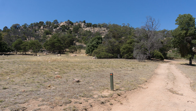
View from near Cork Oaks cark park. Good to see orange guide marker on the post:
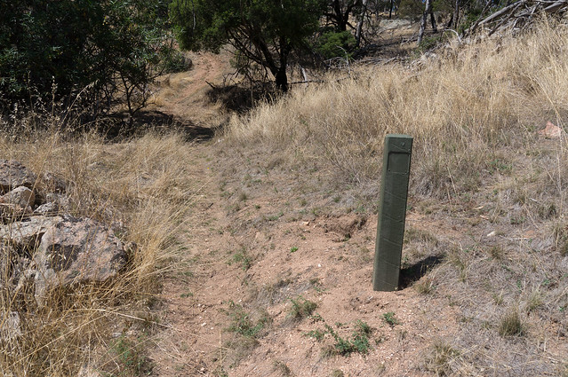
Not far along we see that some markers are only partially there. This is part of the ascent from the car park to the Lollipop Tree:
It wasn’t that difficult to get to find the obvious Lollipop Tree. Great views from there and the Trig Marker just near it


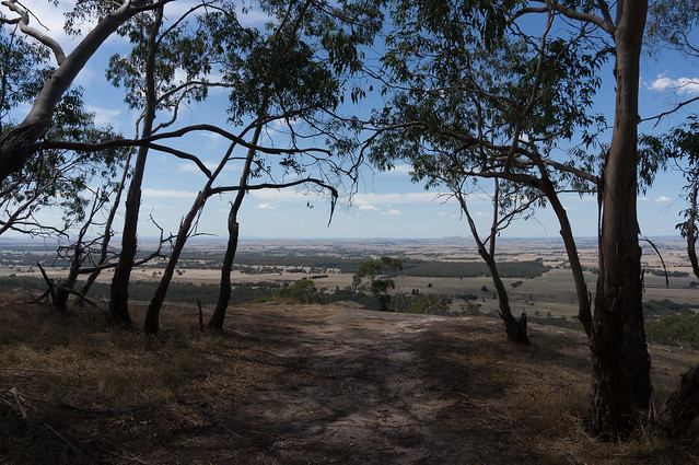
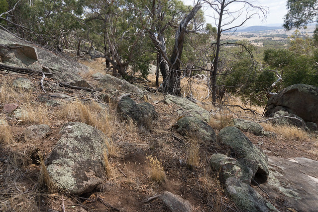
The ‘obvious’ lookout not far past the Lollipop Tree (LT). See logs and map. Well worth the small diversion :
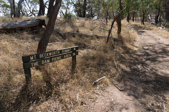
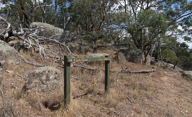
Then back the way you came to near the LT. Just down from the LT there’s this obvious sign. I followed it towards the Dam Picnic Area:
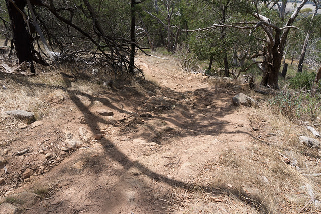
From memory, this was not long after I began the descent to The Dam Picnic Area. The track I’m on is pretty worn out:
I wasn’t expecting this, but took this ‘short cut’ back to my car at Cork Oaks.
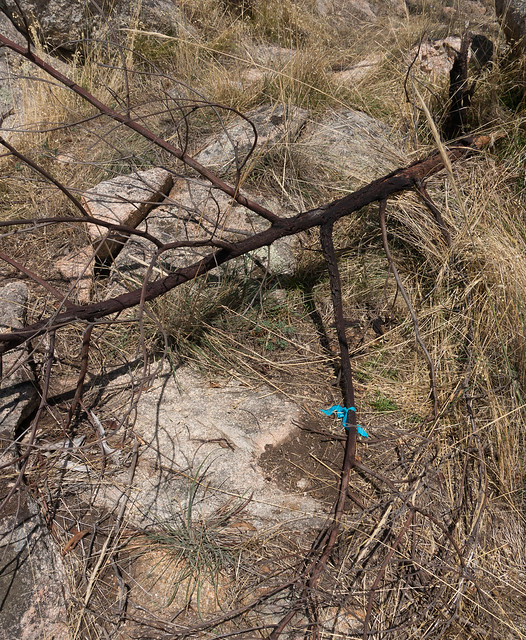
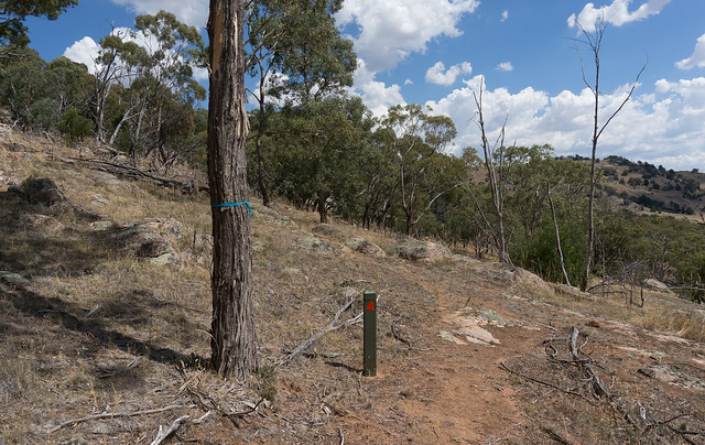
On the ‘short cut’ the signs and markers vanish pretty quickly. See the blue ribbon the fallen branch? I did and (correctly) headed that way. This is where you should keep heading “forward and down” – but looking for the markers:
And there’s another little clue that I’m heading the right way:
Good! A proper marker and blue ribbon. Double good:
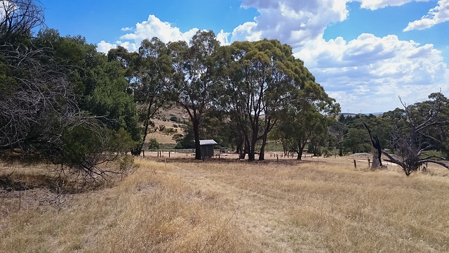
You cross an old, dry creek or water race and there’s the toilets at Cork Oaks. All done:
Walk: GPS Logs and Waypoints
These are the 2 raw GPS logs in OziExplorer with “Internet Maps” (aka OSM). I basically went anti-clockwise from MTBW01 (Cork Oaks car park). Red is the outbound to the summit (“Mount Beckworth 629”). Blue is the return from the Obvious Lookout (MTBW02) and showing the shortcut turn off (MTBW03). I turned off the GPS at the Lollipop Tree and back on again at the Lookout. Waypoints after image. Click to see larger version:

Waypoints

Driving there from Clunes (there are no signs)
I should say: as far as I know – after 3 trips – I can find no obvious Go This Way To Mt Beckworth signs. Based on a log I took, I drew this. (OziExplorer hid the road names with the real log’s line.) Part 1 of 2. Click to make bigger:

Clearly there are other ways. And part 2 of 2 is next. The green bit on the LHS is Mt Beckworth. Follow the signs to Cork Oaks, viz. turn right:
