
Today you can get from Melbourne to London in a day and a bit. 130 years ago it took five times that to get from Melbourne to the Victorian goldfields. They were not that far from where Lake Eildon is now located.
On March 25th 1862 the real-life Captain Solomon left Yea for a trip to the recently discovered goldfields at Jericho near Woods Point. Today this journey takes a few hours. It took Captain Solomon, aka Captain Blowhard, nearly 7 days. At one point he ‘jokes’ about putting a gun in his mouth rather than enduring yet another 45 degree climb up yet another mountain.
In 2001, I found a copy of Captain Blowhard’s journal in a second hand book store and decided to try and retrace his steps. It’s a fascinating journey, made even more enthralling by Blowhard’s vivid and entertaining writing style.
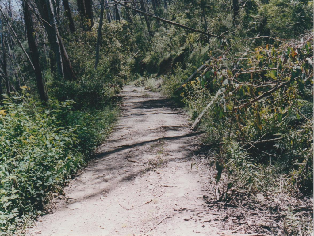
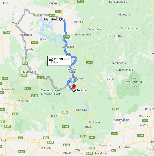
Even today it is not easy to make your way to where Jericho was. Find Seymour and head roughly East for about 160 kilometres, skirting Lake Eildon’s southern flank, until you arrive at Jamieson. Turn South and note that the bitumen stops. About 60 kilometres along you’ll come to the tiny town of Woods Point. Then the fun really starts. Another 37 kilometres of narrow mountain road, including 10 kilometres of track that nervously grips to the side of a valley [see note 1] , and you arrive at where Jericho was. It’s been the best part of 260 kilometres.
It was here in this lonely, isolated valley that gold was found in late 1861. And it was to this very point that the good Captain Solomon was headed less than 4 months later
What today takes half a day in air conditioned, CD-driven comfort, took Solomon nearly 7 days. You need only drive a few minutes from the township of Eildon and up to the Mount Pinniger lookout to see why. The view to the south-east is breathtaking. It’s like a frozen, angry sea.; wave after wave of rolling mountains, all apparently placed to be exactly between you and where you want to be.
In late March 1862, they stood between Captain Jonathon Solomon and the golden specks waiting for him on the banks of the River Jordan at Jericho. Captain Solomon, writing under the not-so-secret alias of “Captain Archilles Von Humboldt Blowhard” was kind enough to document his journey, from near Seymour on to Woods Point and then down into Jericho.
His journal has been subsequently reproduced in books such as “Tracks to the Wood’s Point and Jordan Goldfields”. It allows us to follow his route. Even today most of the journey is through rough, secluded country.
Captain Blowhard set out from Yea on March 25th 1862. He followed the Goulburn River for a few days, roughly through the site of what was to become Alexandra and Eildon towns and ended up at Jerusalem Creek. This is near the southern flank of where Lake Eildon is today. He describes the “excellent grazing country” he has seen and makes references to “hundreds of acres of land it would be impossible to surpass in quality.”
By now it’s been two days and he doesn’t seem to be far from today’s Mount Pinniger lookout. In actual fact, it’s three days since he left Yea, as he lost a day due to rain. He dryly notes that “the climbing commences here” and after the “considerable exertion” he climbs his first major hill. As he is writing with hindsight and therefore aware of what was to come, he makes the somewhat ironic comment that this was a “great feat.”.
Today this is a smooth ride through the jutting, bald hills around Alexandra. It takes about one full playing of the Best of Split Enz CD.
Blowhard then climbs up and down into the Big River Valley, crosses the flooded Big River and spends a miserable night near where Enochs Point is now located. As measured today, the Big River Road turn off is about 50 kilometres from Alexandra, Enochs Point is another 15 kilometres on a gravel road through a steep valley.
Day 5 is clear and around 8am Captain B starts the climb up the Mia Mia Hill. He has been told it’s no more than four miles to the top and has it confirmed, before he leaves, that, yes ,it is indeed “up hill all the way”. His reaction is priceless; he “naturally look(s) to the priming of (his) pocket pistol.”
He writes that the climb is at an angle of 45 degrees. After thinking he is about halfway, he is mortified to hear sounds below that indicate he is only a few hundred feet up. His response to this realisation: “(you) eagerly apply your lips to the pocket pistol.”
In 2000 this climb is still a mongrel. Not sure about the 45 degrees, but the fairly rough 4WD track climbs and climbs for about 5 steep kilometres, with the reward of spectacular views at the top. Blowhard noted this too, commenting on the “fine sight” with “vast mountain gorges on every side”. He dropped down into Gaffneys Creek and then climbed the “steepest spur of all” (known as Raspberry Tart) out of the valley and up to the “German’s restaurant”, where he spent the night. This final climb took 5 hours.
Day 6 seemed less stressful as he made his way to Woods Point, where he spent his final night on the road. Day 7 dawned with the surprise of an overnight fall of snow. He spent all morning climbing up yet another steep – but now snow covered – track from Woods Point to Emerald Hill. Today Emerald Hill is known as Matlock Hill and the 7 kilometre climb out of Woods Point to this hill is still steep, but barely 2 songs long. However, the 360 degree views are as magical now as they were 138 years ago.
From here, it was a short mostly downhill descent into the Jordan Valley and the Jericho diggings. Captain Blowhard arrived at the bustling, busy township of Jericho at about 4pm on Day 7. It was March 31st 1862.
There are now less people in the Jericho district than the 1200 or so back in the 1860’s. To be precise, about 100% less. It’s vanished. It burned bright, burned short, then burnt out. Literally. A decade after the gold was first discovered it seems to have petered out, so by the 1870’s only two of the seven hotels remained. Not long after the First World War even those two closed.
It would seem that by 1937 the town was pretty much deserted. The Black Friday fires in 1939 did the rest. One house survived and in it the one family, who continued on with gold sluicing activities. When they moved away in the 1950’s, the Jordan valley fell silent.
Today the main inhabitants are 24 million blackberry plants. They are everywhere. They bury history in a nasty coat of green barbs. Unlike Walhalla, where you can stand today, holding an 1892 photograph and get a reference point, Jericho has been totally reclaimed by nature.
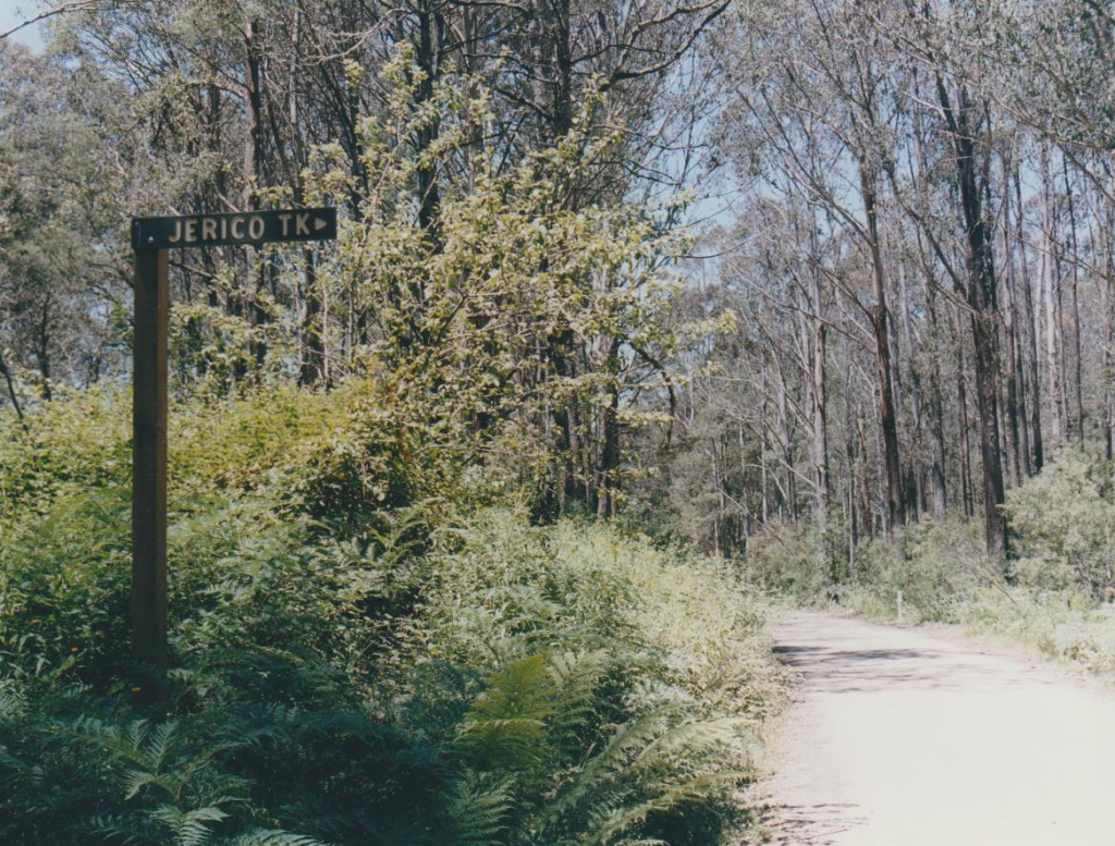
Photos of my 2001 drive into the Jordan Valley
References:
“Tracks to the Wood’s Point and Jordan Goldfields” – R.W. Christie
“Jericho on the Jordan” – J.G. Rogers
“Ghost Towns of the Mountain Goldfields” – L. Steenhuis
Adventurer Map series from Paoletti’s Maps and Videos Pty Ltd
“Gold for the Finding” – Owen F. Tomlin et al.
Notes:
[1] This was the route I took from Woods Point the first time I went into the site of Jericho. It’s the Victor Spur Track. Later on I used the much shorter Jericho Track. On this first trip, I did try and find the Jericho Track, but turns out the sign had been removed.
On my second trip, I did get conflicting advice re: Jericho Track. One bloke – to be fair he was miles away at Tralagon – remembered it as being very steep and “in first gear the whole time”. Mmmm. Later that same day a ‘local’ – to wit the bloke at the Woods Point Store – said it was quiet easy. He was right.