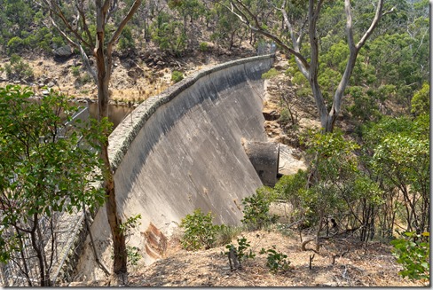
About 30 minutes south of Ballan, in the middle of the dry Brisbane Ranges, you’ll find the first ever Concrete Dam wall built in Australia.
It was constructed in 1873 and is happily sitting there today. The surprisingly large wall just appears out of nowhere as you walk up a steep-walled creek valley from your car. I’m not sure if it still supplies water (mmm, see Reference [2] at the end).
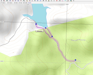
Here’s the walk map and location of the Reservoir area (inset):

Click on any picture to embiggen it ![]()
Points on map are:
- Car park (start/finish)
- Track junction
- “Top” of the Dam Wall area
- “Base” of Dam Wall
If you can read a GPS app on your phone – and you should be able to! – my map grid is UTM, with 500m grid lines. It’s the standard WGS 84 datum.
Important: The walk is quite easy, but first there’s about 2k of driving on unmade (gravel) road, to get to the parking area where you start the hike from. You won’t need a 4WD, but take it easy.
Getting There
*rough instructions* as my focus is the walking bit:
- Drive to Ballan
- Optional: Stop at the small, but excellent, Ballan Bakery and have a cuppa with a Health Slice (lovely). They also make up excellent fresh rolls and sandwiches.
- Set your GPS thing for Stony Creek picnic area. It’s in Staughton Vale VIC.
- It should route you down the road towards Geelong etc.
Walking
See map for numbers. You should explore both the base of the Dam Wall (4) and the views from the top of it (5)
When you are at the Base, have a look inside the ‘cathedral’ like structure as it has original (?) cogs and wheels, probably used to open and close the outlets.
- Park at the Sony Creek picnic area car park (1) on the map. There are toilets and tables here.
- Walk along the main, signed Anakie Gorge walk, crossing some small concrete creek-bridges
- You’ll soon arrive the Burchell Trail intersection (heading off on your left ) (2)
- For the quick ascent to the Top (3) veer left up the Trail
- For the quick walk to the base of the Wall (4) just continue straight ahead on the Walk along the creek valley.
- The Burchell Trail is more like a road.
- When done, return back to (2) and head off to your second point of interest
- When finally done, return back to the car (1). Then head back to Ballan or home etc.
This picture is taken from the top but you can see the ‘cathedral’ like water-exit structure at the Base of the wall:

Bonus: I took some phone video on the day of my most recent visit (Jan 18th, 2020) and quickly edited two clips together. If you are alert enough, you can tell I shot them in reverse order; I do the ‘intro’ in the 2nd half. Plus, also, I got the dates wrong …
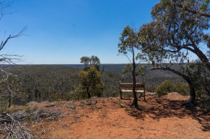
I first wandered into this area in 2015, doing the excellent Ted Errey Nature Circuit walk. From memory it was about 13km. As I said, the Brisbane Ranges are very dry and parts of this Circuit walk look very red, almost like the Pilbara (!) :

References
[1] Vic Heritage Database Report on the dam wall
[2] The International Database and Gallery of Structures report on the dam wall. Note: this says “Status: in use” (!) That could mean the wall is still intact and holding back water…and/or there is water being drawn from it
