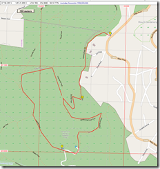
About 6.6 km total. Rankin Track quite steep.
We had brunch at The Basin, then drove up The Basin – Olinda Road towards Olinda.
Car near the power substation at (1). Walk quite level, then the descent starts at (2). Doongalla site – upper picnic ground (3) – great place for lunch.
Suggest you walk down the hill to the lower picnic ground at Doongalla; the Stables area. It’s lovely. Then back up to Camelia track, up Rankin Tk, then right onto Channel 10 tk. Re-trace route back up to car (i.e. Zig Zag tk etc). Click on image below for full size. Note: some track names may have changed. Update: some photos at the end, after map.
Photos
Fog quickly lifts at the very start. On – on near – Kyeema Track.


